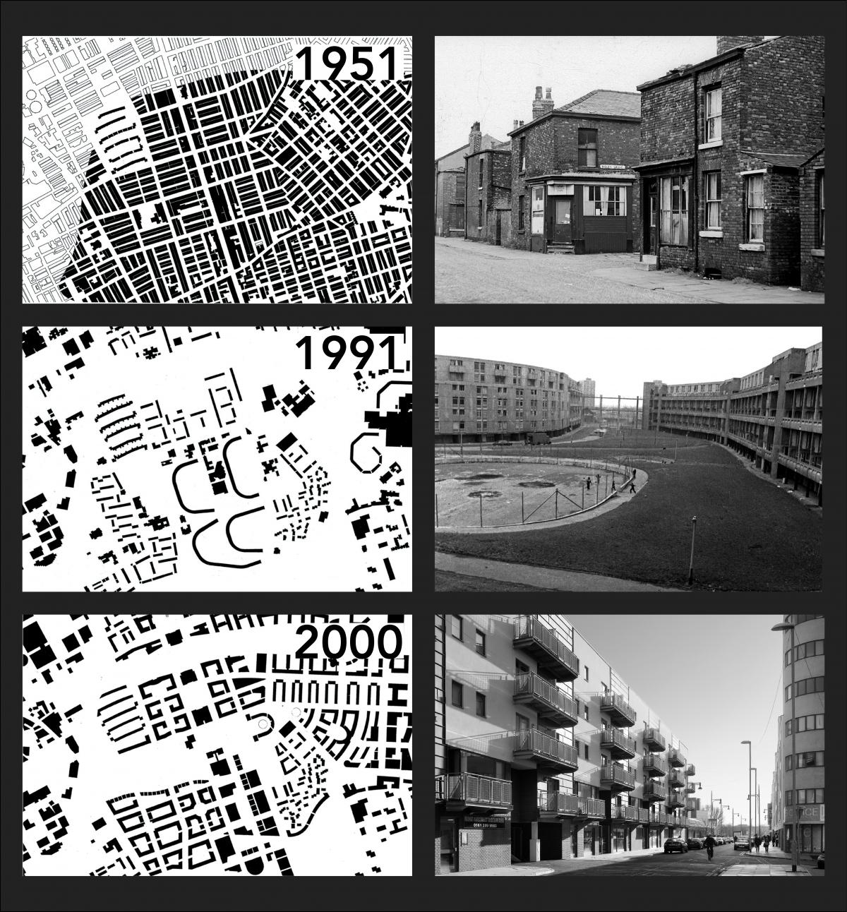
Hulme, an inner urban area located on the southern fringe of Manchester city centre, has a long history of urban renewal.
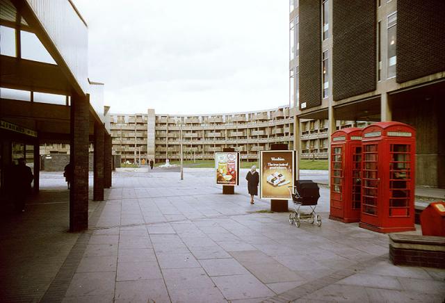
The area had suffered badly from inner-city decline during the late 20th century following the construction and subsequent demolition of Hulme's ‘crescent’ developments, the largest housing project in the country at the time.

In 1991, we were appointed by Hulme Regeneration Limited – a joint venture between Manchester City Council and AMEC – as lead design consultants to create a concept and masterplan for an area comprising approximately 230 acres of inner-city land.
Hulme today is a product of this second, altogether more wave of regeneration, which has restored a coherent, connected urban form to an area that had been fragmented by the crescents and other developments.
Working density
At the heart of the masterplanning strategy was an understanding of the underpinning scale and development of the area, which had been lost during the 1960s. Our approach sought to increase density within the area by reinforcing its streetscapes and re-establishing its neighbourhoods, enabling the area to integrate both new and existing communities harmoniously.
Permeable street layouts encourage movement throughout the area, helping to foster a sense of security and activity.
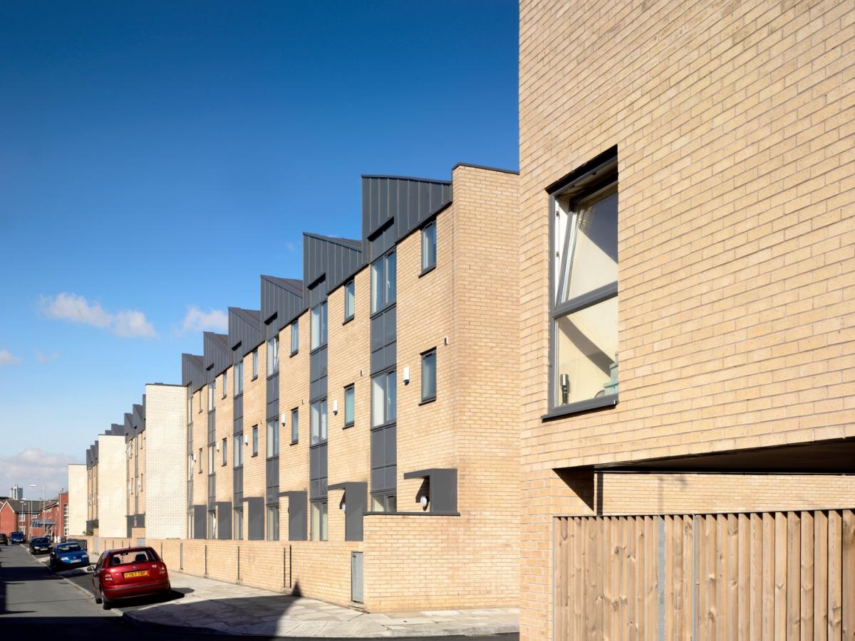
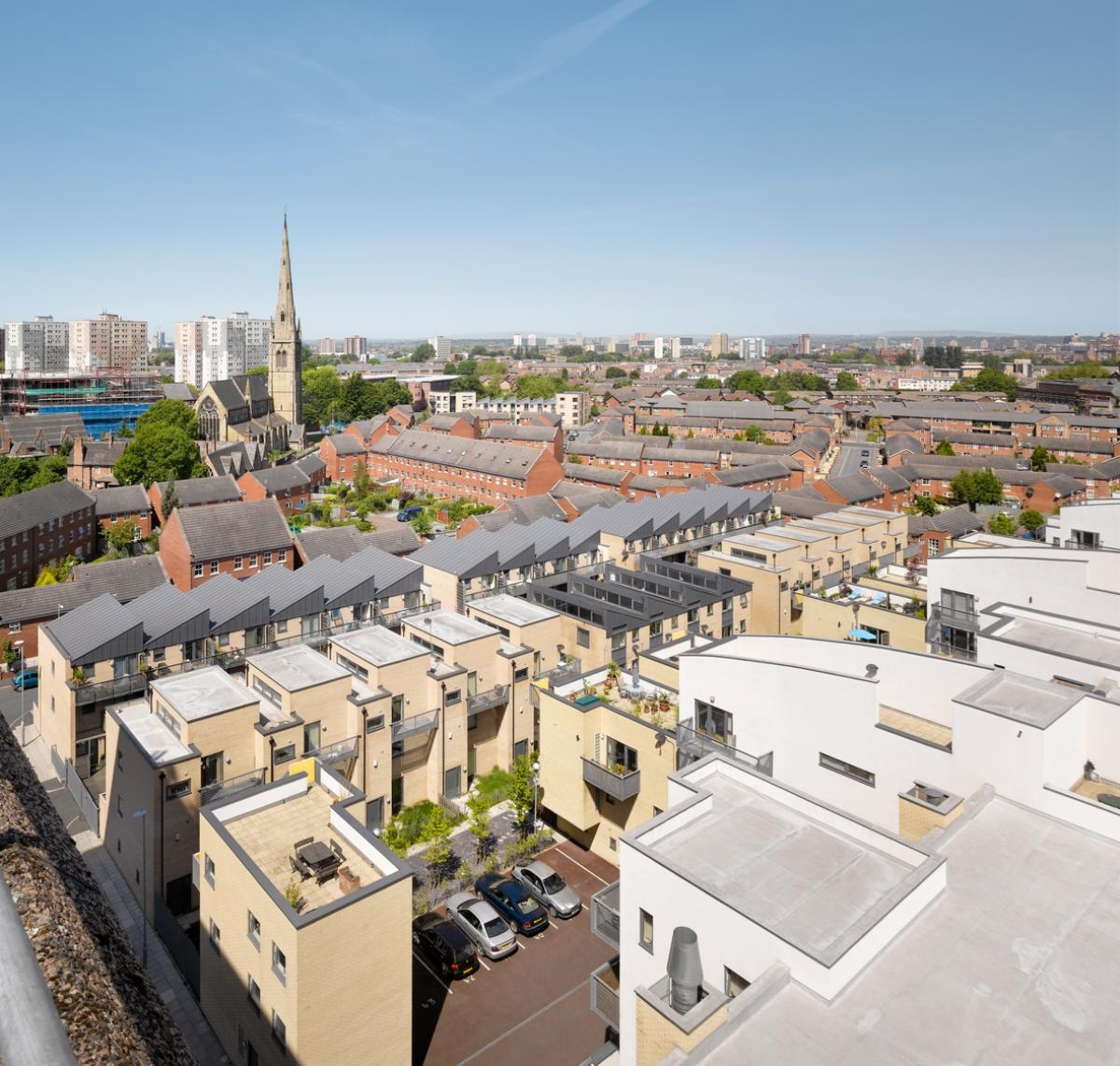
Hulme High Street
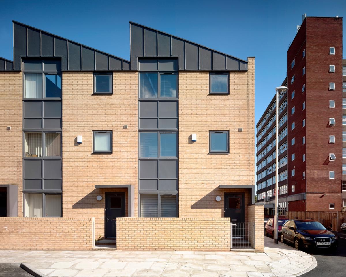
A number of developments were identified within the regenerated area, with Hulme High Street central to the regeneration of the area as a whole. The high street comprises 211 apartments and townhouses, which sit in linear and circular blocks and form the new Hulme High Street, connecting through to the Princess Parkway, one of the main arterial roads into Manchester city centre.
Each of the blocks has been designed with distinctive forms and of varying heights, creating a strong sense of identity and place inherent in the masterplan outline.
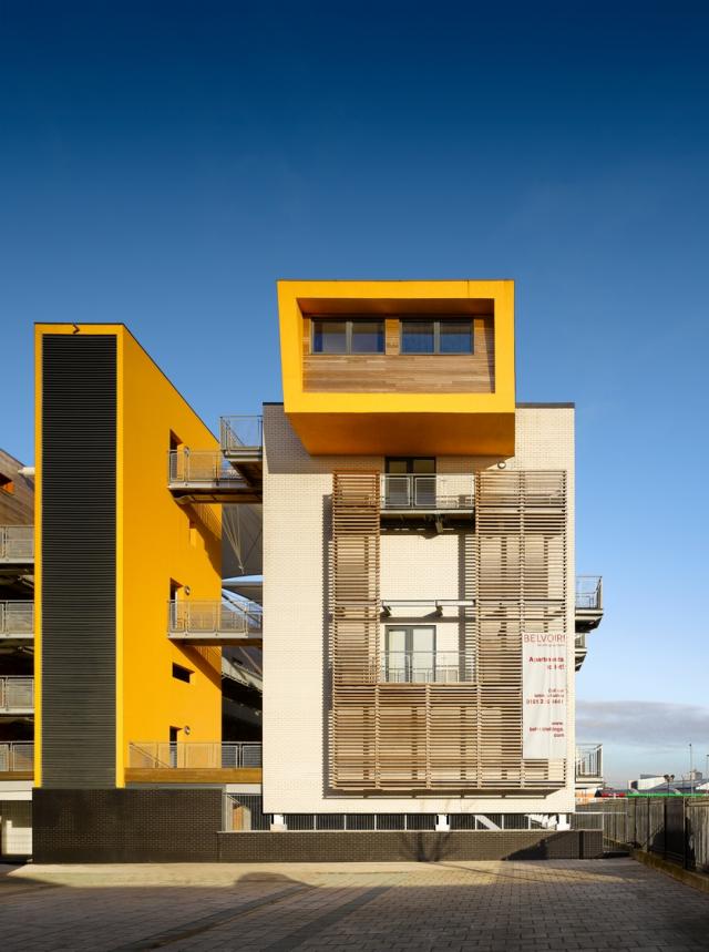

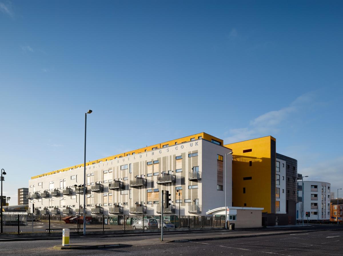
The Life Building
Forming the final phase of development in the Hulme masterplan, the Life Building comprises commercial units, apartments, maisonettes and townhouses, and is distinguished by a large covered central courtyard.
Within this development, and the circular building at the end of Hulme High Street, all parking is underground, leaving the ground floor free for communal entry and activity.
The design of each of the development plots contributes to a contemporary appearance for this new sector of Hulme. Each of the buildings maintains its own distinctive character through individual form, creating a strong identity and sense of place.
The placemaking strengths of the schemes collectively are the product of carefully considered responses to the qualities and juxtapositions of the individual sites and how they can contribute to a clearly recognisable neighbourhood.
Urban Design Code
The Hulme regeneration is regarded as an example of best practice and has since been taken as a precedent for many subsequent inner-city regeneration schemes.
Following its success and relevance to other problem inner-city areas, we contributed to the creation of the Hulme Regeneration Urban Design Code. The code was subsequently adopted by Manchester City Council and formed the core document from which the City Design Code was developed.
Image credits
© Daniel Hopkinson
Historic images provided courtesy of Manchester Metropolitan University